Categories
GIS

Markets and Transportation in Antebellum Northern Virginia

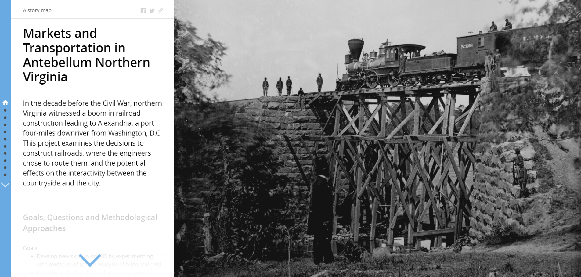
I created this story map in Spring 2016 as a digital component of a final research paper for the course History and GIS, during my first year at Binghamton University. It is the earliest example of my digital humanities work.

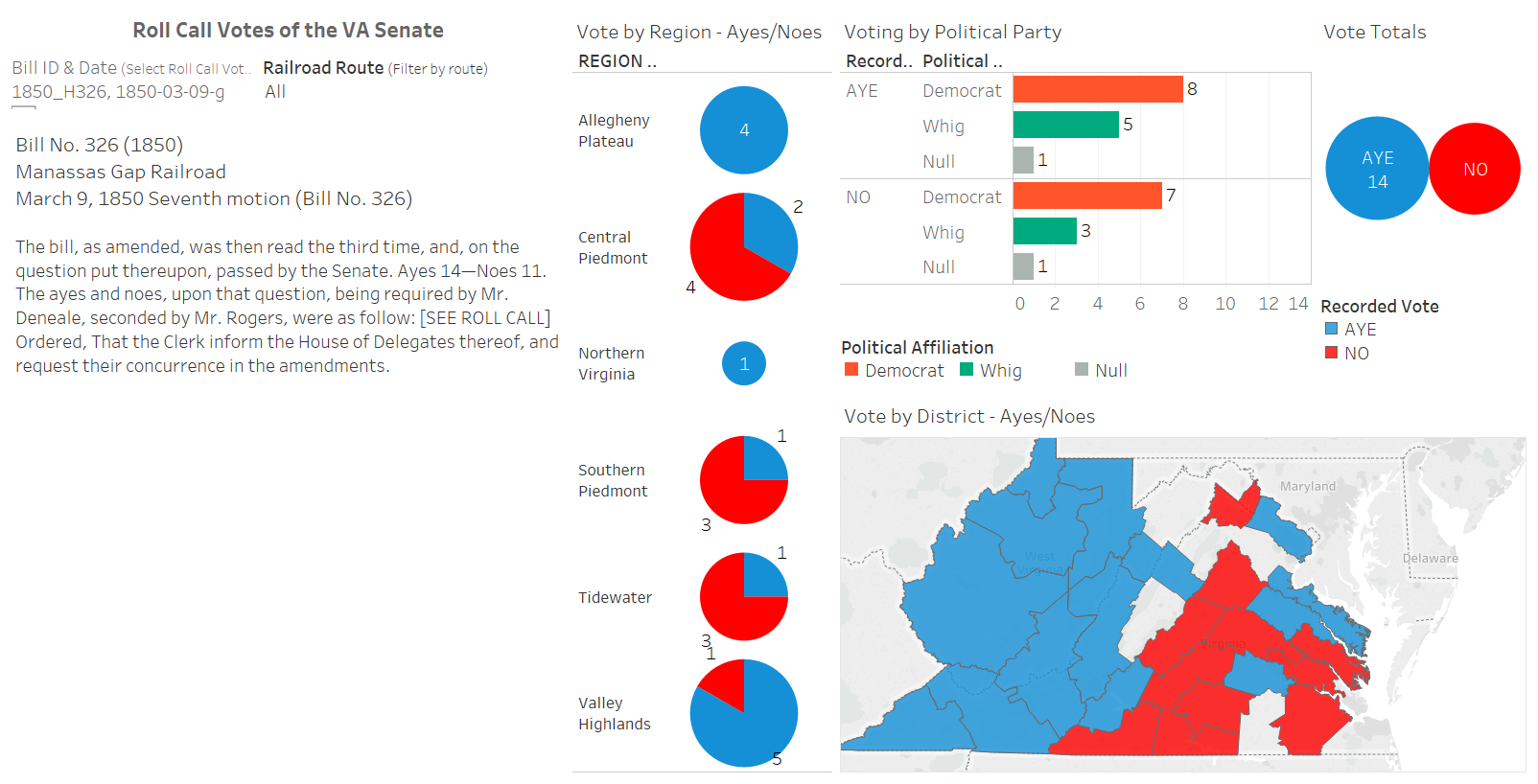
The project studied how railroad development in antebellum northern Virginia unevenly altered the commercial landscape. It used exploratory mapping and network analysis to plot and investigate railroad development in antebellum northern Virginia. Since then, I have continued to revise and enhance the dataset and have used elements of it as the base for additional projects.


https://gis-core.maps.arcgis.com/apps/MapJournal/index.html?appid=a559a800d7e743298962fa2407d60778

Categories
Tableau Virginia

Antebellum Railroad Bills in the Virginia General Assembly

This project uses data visualizations in Tableau to better understand the legislative process to incorporate railroad companies in antebellum Virginia. It employs interactive dashboards to track the progress of bills through the Virginia House of Delegates and Senate. Explore the dashboards in the project overview or select one of the guides for bills related to the incorporation of the Manassas Gap Railroad: the failed attempt to incorporate the company in the 1848-1849 session OR the successful attempt completed in 1850.

css.php